Arctic Cyclone on the Way: Severe Weather Alert, 100 km/h Winds, and Low-Altitude Snow. Emanuele Bompan (3BMeteo) Explains What’s in Store
We’re almost there. After weeks of deceptively spring-like weather that had us fooled, winter is about to roar back with unprecedented fury. Just a glance at the models today makes it clear this isn’t the usual downturn: a true Arctic-origin cyclone is heading straight for Italy. And when someone like Emanuele Bompan, the long-time face of 3B Meteo, calls it a "significant event," those who remember know he’s not making empty promises. We’re talking about a vortex capable of bringing the country to its knees for at least 48 hours.
The Arctic blast will start making its presence felt within the next few hours, but the peak is expected between Thursday and Friday. The vortex will deepen over the Ligurian Sea, setting up the perfect conditions to bring frigid air and instability across the entire peninsula. There’s one word to sum it up: wind. Gusts could exceed 100 km/h along the Tyrrhenian coasts and the Apennine ridges. Local authorities have already started issuing strong wind alerts in several regions, from Trentino down to lower Lazio: the advice is to secure anything that could blow away on balconies and in gardens.
The Cyclone’s Three Key Fronts: Here’s What to Expect
To get a clear picture of what’s about to happen, you need to look at three key factors. First is the wind, which will reach gale-force intensity. Second is the snow, which will return to unusually low altitudes for this time of year. Third is the speed at which this whole event will unfold.
- Gale-force winds: Gusts exceeding 90-100 km/h in Tuscany, Lazio, Campania, and the Apennine areas. Rough seas along exposed coastlines.
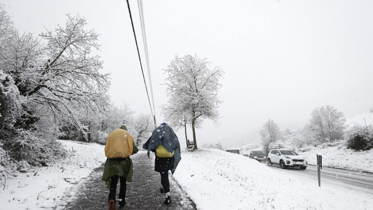
- Low-altitude snow: Expected already below 600-800 meters in the Central Apennines. Some flurries can’t be ruled out on the plains between Emilia and the Marche region.
- Fast-moving system: The worst conditions will be concentrated within a 36-hour window. By the weekend, high pressure will try to make a comeback.
Where and When It Will Hit Hardest
This cyclone won’t be subtle. We’re talking about a vortex that will feed itself over our seas, bringing extreme conditions in succession. In the Northwest and the Alps, snowfall will be heavy above 600-800 meters, with exceptional accumulations above 1500 meters. In the Central Tyrrhenian area, the main concerns will be powerful thunderstorms and rough seas, with snow on the Tuscan-Emilian Apennines at levels reminiscent of deep winter. In the South and on the islands, the worst weather will arrive between Thursday and Friday, with the risk of violent downpours in Sicily and Calabria just as the vortex shifts eastward.
Anyone planning to travel would be wise to check 3BMeteo before heading out. Tonight’s Weather Forecasts indicate gusts strong enough to disrupt traffic, with possible road and highway closures on Apennine passes. And for those in Rome, I know you’re used to just about anything, but get ready for a sharp temperature drop between Thursday and Friday, accompanied by winds that will send umbrellas flying.
The good news? When a cyclone has this kind of force, it usually burns out quickly. By the weekend, high pressure will try to peek through, bringing back some stability and milder temperatures. But until then, hold on tight: winter has decided to remind us it’s still here, and it’ll do so with the roaring voice of the wind and the white silence of out-of-season snow.