Storm Samuel puts Canary Islands on alert: Hurricane-force winds and rough seas in the coming days
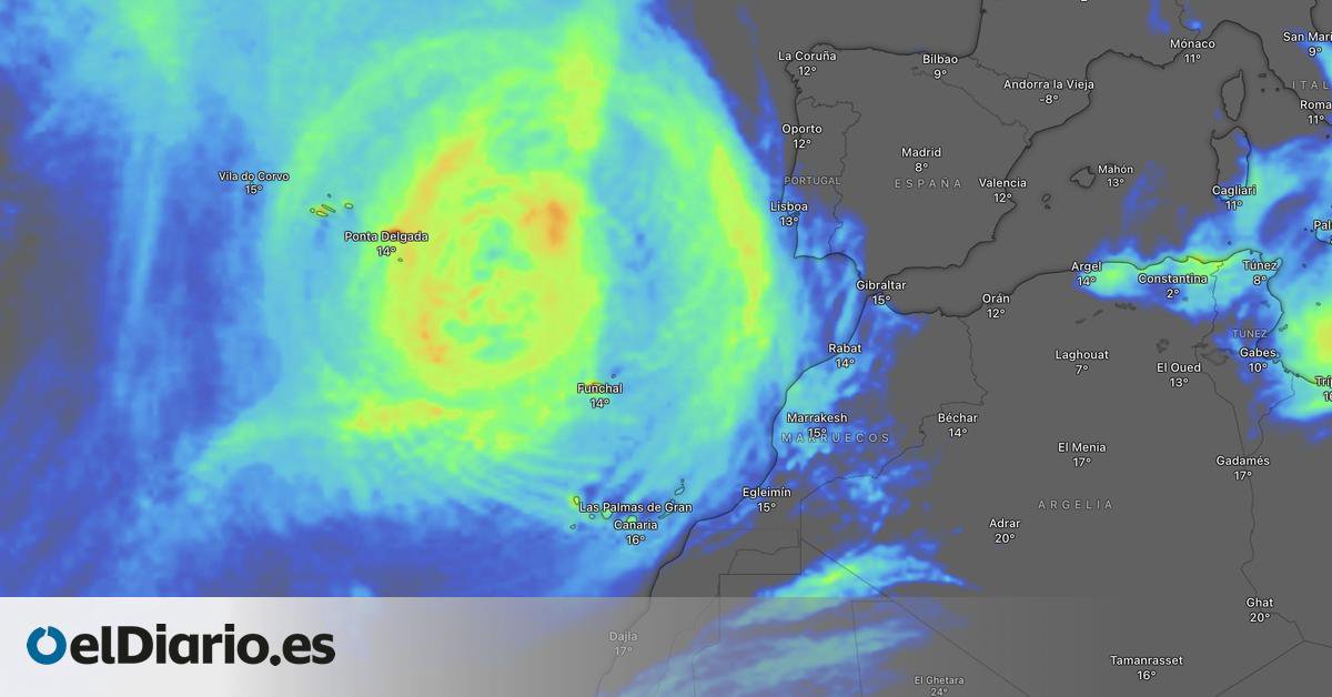
If you stepped outside this morning and felt that damp, blustery air, you weren't imagining things. The Canary Islands are bracing for the arrival of Storm Samuel, and weather services have already swung into action. This isn't just another warning: we're talking about a weather system that's set to keep us on edge through the weekend and, in all likelihood, into the early part of next week.
We've seen these things brew for years, and the one heading our way now has an old-fashioned name but the temperament of a rebellious teen. Samuel is going to pack a punch. Meteorologists are crystal clear: from this very afternoon, the archipelago will start to see conditions deteriorate across the board. Wind gusts on the peaks and north-western slopes of the more mountainous islands could top 100 kilometres per hour. And here's the kicker – sea conditions are going to get seriously ugly, with waves potentially reaching 7 or 8 metres. This is not a day for a stroll along the promenade or trying to snap a dramatic selfie; better to watch it all unfold from home with a nice hot cuppa.
Which islands will bear the brunt of Samuel?
As someone who's lived through a fair few storms, I can tell you that all of them will feel it, but some are going to cop the worst of it. According to the models, the islands with the most rugged terrain will be hardest hit by the wind and rain. We're talking about Tenerife, La Palma, Gran Canaria and La Gomera, especially in the upland and mid-altitude areas. There, rainfall could be locally heavy and persistent, particularly between Tuesday and Wednesday. The rest of the archipelago won't escape either: overcast skies, unsettled conditions, and that rolling swell that leaves some feeling decidedly queasy.
And that's not all. The meteorologists seem to be pulling female names out of thin air. It turns out that hot on Samuel's heels, some are already starting to whisper the name Teresita. Yep, you heard that right. A new disturbance that could form to the west of the islands and make things even more complicated towards the end of next week. For now, it's just a rumour, but in the world of weather, when proper names start popping up, it's best to have your brolly and waterproof jacket at the ready.
What to do during these stormy days
No one's here to tell you how to live your life, but those of us who've seen a few too many branches come down know it pays to follow a bit of advice. Local authorities, along with the meteorologists, have issued warnings, so take note:
- Stay away from coastal areas. The swell can be treacherous, and a wave like that won't think twice. If you live near the coast, secure your windows and bring in pot plants or anything else that could take flight.
- Take extreme care on the roads. Wind gusts can destabilise your vehicle, especially in high areas and when exiting tunnels. Ease off the accelerator and increase your following distance.
- Stay informed. Forecasts can change, and while we'll keep you updated here, keep an eye on official weather information channels and follow any advice from civil protection.
- Don't underestimate the rain. If you need to go out, grab a raincoat and suitable footwear. Roads can turn slippery and footpaths can become an ice rink.
The upside of living in these parts is that once the storm passes, the sky clears and that glorious light we all love returns. But until then, it's time to hunker down and see it through. And with Samuel's permission, we'll be keeping a close eye on this Teresita character looming on the horizon. You know how it is with the weather – you can never let your guard down.
Catch you all on the other side of this storm, with that fresh, clean air and the comforting knowledge that, once again, the Canary Islands will weather the storm. But in the meantime, wrap up warm, batten down the hatches, and if you can, just stay cosy at home. Don't let the wind wipe the smile off your face.