Storm Dave Ireland: Status Yellow wind warning, travel disruption and your Easter weekend guide
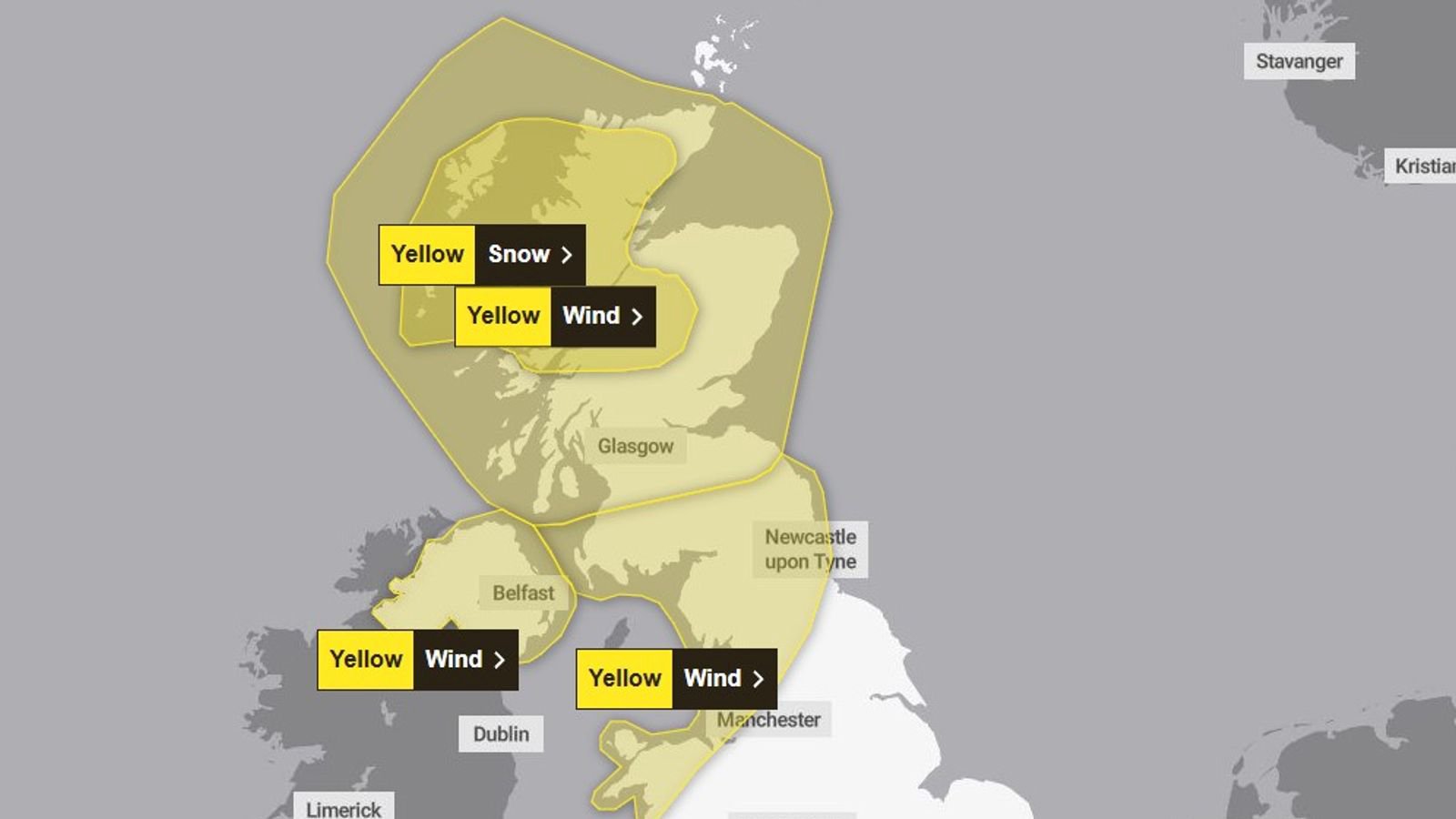
Ah here, would you look at that. Just when we thought we might sneak a dry Easter weekend for once, along comes Storm Dave to wreck the whole lot of us. The naming happened on Thursday morning, and within minutes, a Status Yellow wind warning was slapped on the entire country. So much for the chocolate eggs staying put on the table.
I’ve been watching these Atlantic lows roll in for years, and this one‘s got that familiar nasty edge to it. We’re not talking about a bit of a breeze that‘ll knock over your garden furniture. This is the real deal—damaging west to southwest gusts, spring tides doing their worst, and the kind of coastal overtopping that’ll make the promenades in Salthill or Tramore look like a scene from The Perfect Storm. The warning kicks in at 3pm on Saturday and doesn't lift until midnight on Easter Sunday.
What‘s actually heading our way?
Let me break it down for you plain and simple. Saturday is the day we hunker down. Word from the weather desk is that this is a rapidly deepening area of low pressure. In plain English? The storm intensifies fast as it hits us. We’re looking at strong, gusty southerly winds that‘ll veer westerly by Saturday evening. And because the timing coincides with high astronomical spring tides, the usual spots along the west and north coasts are going to get hammered by wave overtopping.
Here’s what that actually means for you on the ground:
- Fallen trees and branches—especially in areas where the ground‘s already soft from the recent rain
- Coastal flooding around high tide times, particularly in low-lying Atlantic spots
- Debris and loose objects becoming airborne—yes, including your neighbour’s trampoline
- Difficult travelling conditions on exposed roads, especially on Saturday evening
Up north, the same yellow warning covers the six counties from 2pm Saturday until 2am Sunday, with peak gusts hitting 50-60mph widely and stronger in exposed coastal bits. So if you‘re heading across the border for the long weekend, don’t assume you‘ll escape it.
Your hour-by-hour guide to riding out Storm Dave
Right, so you want to know how to actually use this storm guide properly? Here’s the timeline I‘d bet my boots on based on the latest runs.
Friday (Good Friday): Not the worst, but don’t be fooled. The morning starts largely dry and bright—typical “calm before” stuff. By afternoon, cloud rolls in from the southwest and brings outbreaks of rain and drizzle. West Connacht could see some spot flooding where the rain‘s heaviest. Temperatures top out at 10 to 14 degrees, so not exactly balmy.
Saturday (the main event): This is where Storm Dave earns its name. Winds strengthen from the morning, but the real chaos kicks off after lunch. By 3pm, when the yellow warning goes live, we’ll have strong and gusty southerly winds with coastal gales. Rain turns heavy and widespread through the day. Highest temps around 11 to 14 degrees—mild enough, but you won't be worrying about the temperature when your bins are doing cartwheels down the road.
Saturday night into Easter Sunday: The rain clears out overnight, thank God, but don‘t get comfortable. Clear spells follow, and then we get scattered showers—and here’s the kicker. Some of those showers could bring hail or even sleet, mainly on higher ground. Temperatures plunge to 1 to 4 degrees. So if you‘re heading to an Easter sunrise service, wrap up like you’re climbing Everest.
Easter Sunday: A brighter day overall, thank the heavens. Sunny spells and scattered showers, but the westerly winds stay fresh. Early risers might catch a hail shower on the hills, but by afternoon it‘s just cool and breezy. Highs of 7 to 10 degrees.
The coastal flooding risk—no messing about
I’ve seen enough storms come through Galway, Mayo, and Donegal to know that wave overtopping is the silent danger everyone underestimates. People love getting down to the seafront to watch the big waves. Don‘t be that eejit. The combination of spring tides, storm surge, and persistent onshore winds means water levels will be higher than usual. Low-lying exposed areas along the Atlantic seaboard are genuinely vulnerable.
The latest advisory spells it out: coastal flooding is likely, especially around high tide times. If you live in one of those spots, move the car up to higher ground before Saturday afternoon and don’t go for a “look” at the waves. I‘ve pulled too many stories out of the files about people who thought they’d just take a quick photo.
Your Storm Dave survival checklist
Look, I‘m not your mammy, but I’ve been through enough of these to know what works. Here‘s your review of the essentials—tick these off before Saturday lunchtime:
- Secure the garden: Trampolines, bins, garden furniture—if it can move, it will move. Bring it inside or tie it down properly.
- Charge everything: Power outages are on the cards. Get the phones, laptops, and portable chargers topped up by Saturday morning.
- Check your route: If you absolutely have to travel, look at the conditions at your destination and along the way, not just where you’re leaving from.
- Keep the ESB number handy: 1800 372 999 if the lights go out. PowerCheck.ie will show you estimated restoration times.
- Stay updated: The national weather app and website are your best friends. Warnings can change, and this system still has some wobble in the models.
What about Monday and beyond?
Don‘t put the wellies away just because Dave moves on. Monday looks rather windy again—fresh to strong southerly winds, cloudy and damp with patchy rain and mist. Milder, though, with highs of 10 to 14. And the longer-range outlook? More Atlantic lows lining up like they’re queuing for a session. Unsettled for most of next week, so enjoy any dry spell you get.
One last thing before I let you go. I know it‘s Easter weekend. I know you’ve got plans. But a Status Yellow isn‘t a suggestion—it’s a heads-up from the people who track this stuff for a living. Storm Dave isn‘t the worst we’ve ever seen, but he‘s no soft touch either. Batten down, stay safe, and for the love of God, don’t go chasing waves.